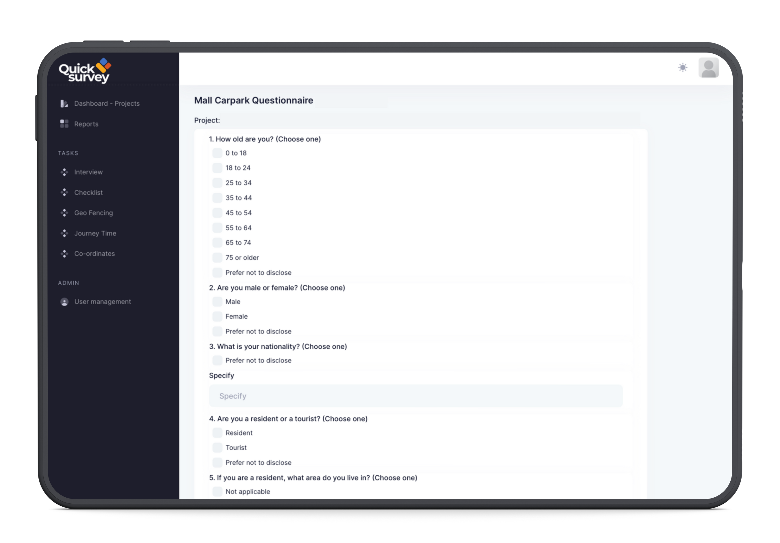
The purpose of a roadside traffic interview survey is to gather information about traffic patterns, travel times, and other factors that can be used to improve transportation planning.
The questions that are asked in a roadside traffic interview survey can vary depending on the specific purpose of the survey.
GEO Fencing
Geofencing is a technology that uses GPS or other location data to create a virtual boundary around a physical location.
Geofencing is a powerful technology that can be used to improve the efficiency and effectiveness of a variety of businesses and organizations.
Journey Time
Journey time is the amount of time it takes to travel from one location to another.
By knowing the journey time for different modes of transportation, travelers can choose the mode that is most convenient and efficient for their needs.
CO-ORDINATES
Coordinates are a system of numbers that are used to identify a point on a map or other two-dimensional surface.
Coordinates are typically expressed as a pair of numbers, with the first number representing the horizontal position and the second number representing the vertical position.
Lorem ipsum dolor sit amet, consectetur adipiscing elit, sed do eiusmod tempor incididunt ut labore et dolore magna aliqua. Ut enim ad minim Lorem ipsum dolor sit amet, consectetur adipiscing elit
Naomi Matz, Botanist
☆☆☆☆☆Rated 5 out of 5
Lorem ipsum dolor sit amet, consectetur adipiscing elit, sed do eiusmod tempor incididunt ut labore et dolore magna aliqua. Ut enim ad minim Lorem ipsum dolor sit amet, consectetur adipiscing elit
Marvin Conte, Plants lover
☆☆☆☆☆Rated 4.5 out of 5
Lorem ipsum dolor sit amet, consectetur adipiscing elit, sed do eiusmod tempor incididunt ut labore et dolore magna aliqua. Ut enim ad minim Lorem ipsum dolor sit amet, consectetur adipiscing elit